We have now formed the Thomas Drafting Cooperative! This represents a family cooperative and brings together a very diverse skill set. The Cooperative consists of myself (Jason Thomas), Christopher Thomas, Bill Thomas and Penny Thomas. We have all been working independently for some time and have now decided to consolidate our skills and experiences to offer more to clients!
We have extensive expertise and project experiences. Much more information is to come once the website is up and running.
Civil Design
Small Site Design
Large Site Design
Grading Plans
Existing and Proposed Surface Modeling
Corridors
Pipe Networks
Stream Restoration Projects
Cross Sections Export to HEC RAS for Hydraulic Modeling
Fish Habitat Project
Large Woody Debris Projects
Bank Stabilization Projects
Dam Removal and Berm Breach Projects
Wetland and Habitat Restoration Projects
Fish Passage Projects
Culvert Replacement Projects
Drinking Water Utility
Wastewater
Water Resources Projects
3D and 2D Water Filtration Systems
DOT Projects for Washington, Oregon, Idaho, West Virginia and Florida
Airports and Runways
Architectural Commercial
Architectural Residential
Foundation Plans
Roof, Truss and Framing Plans
Civil Details
Take offs
Volume Calculations
Sheet Sets
Redline Drafting
Plans Production
New Software Now Available for Client Projects
I am excited to report that we now have many new pieces of software available to our Clients! Below is the shortlist of licenses that we are actively utilizing. Better yet, we know how to use them.
Full Autodesk Infrastructure Design Suite Premium 2014 and 2015 and the
Full Adobe CC Suite !!
Chief Architect (Rental Project by Project Basis)
Autodesk AutoCAD 2014 & 2015
Autodesk Civil 3D 2014 & 2015
Autodesk 3DS Max Design 2014 & 2015
Autodesk AutoCAD Map 3D 2014 & 2015
Autodesk Storm and Sanitary Analysis 2014 & 2015
Autodesk AutoCAD Raster Design 2014 & 2015
Autodesk ReCAP 2014 & 2015
Autodesk Navisworks Simulate 2014 & 2015
Autodesk Intraworks 2014 & 2015
Autodesk Geotechnical Module 2014 & 2015
Autodesk Bridge Module 2014 & 2015
Autodesk Rail Layout Module 2014 & 2015
Autodesk Utility Design 2014 & 2015
Autodesk Revit Structure 2014 & 2015
ArcGIS (Subscription)
Adobe Acrobat XI CC
Adobe InDesign CC
Adobe Photoshop CC
Adobe Lighroom CC
Adobe Illustrator CC
Adobe InDesign CC
Adobe Premier Pro CC
Adobe After Effects CC
Adobe Dreamweaver CC
Adobe Muse CC
Adobe Flash Professional CC
Adobe Audition CC
Adobe Bridge CC
Adobe Edge Animate CC
Adobe Edge Code CC
Adobe Edge Inspect CC
Adobe Edge Reflow CC
Adobe Fireworks CC
Adobe Flash Builder CC
Adobe Incopy CC
Adobe Prelude CC
Adobe Media Encoder CC
Adobe Scout CC
Adobe SpeedGrade CC
Adobe Story Plus CC
Adobe PhoneGap Build CC
Adobe Live Logger CC
Adobe SDK CC
Adobe Extension Manager CC
Adobe ExtendScript Toolkit CC
New Websites
It's official!! The Thomas Drafting Cooperative now has new websites. These are our new addresses and soon the new site will be up. In the meantime, feel free to email me for a portfolio and resume.
Jason A. Thomas
jason.aw.thomas@gmail.com
Gradient-Designs.com
Civil3DDrafting.com
Civil-3D-Drafting.com
StreamRestorationDrafting.com
Stream-Restoration-Drafting.com
ThomasDraft.com
ThomasDraftingCooperative.com
Thomas-Drafting-Cooperative.com
ChiefArchitectDrafting.com
Chief-Architect-Drafting.com
ArcGISMapping.com
ArcGIS-Mapping.com
Simple Channel Realignment Using Breaklines in Civil 3D
Grading a new channel meander, backwater channel or side channel for a stream, wetland and aquatic habitat restoration projects can be quite tedious. This is especially true when you include more advanced designs containing riffles, pools and a meandering thalwag. There are many ways to approach this type of design project in Civil 3D. This post will outline one of the more simple methods for getting some quick volume calculations and a preliminary design

STEP 1: Begin by opening a file containing your EG (Existing Grade) surface. For preliminary excavation quantities I chose to use a rough lidar surface.
In this example the student was not familiar with the newer Civil 3D ribbon menus so I had them turn on the classic pull downs. Do this by typing "menubar" in the command line. Set the Variable to (1) for pull-downs.
STEP 2: Rough in you your new channel alignment with the polyline tool.

STEP 4: Select your feature line just created and right click to select the Elevation Editor. You will see the Elevation Editor as it appears to the right.

STEP 5: Enter the desired tie in elevations at the upstream and downstream locations of your of your new feature line (new channel alignment). These are the actually surface elevations from your EG surface at these locations.

STEP 6: Manually calculate your slope using the upstream and downstream tie in locations from step 5. Keep in mind that this will create a very simple stream channel profile with no pools or riffles. This will not make the fish happy. In the future try to create more advanced stream profiles. Enter the calculated slope in the Grade Back column or the inverse in the Grade Ahead column. Your feature line now represents the intended designed slope of your new channel and now becomes your channel thalwag.
STEP 7: Use the stepped offset tool to create the toe of slope on each side of your channel thalwag. In the pull down menu loaded earlier select GRADING > EDIT FEATURE LINE GEOMETRY > STEPPED OFFSET. Or in the ribbon menu select the stepped offset button in the grading menu. Use the feature line (thalwag) with set elevations and slopes to offset the left and right toes.


STEP 8: Open the "Grading Creation Tools" pane from the ribbon menu or go to the pull down menus and select GRADING > CREATE GRADING. You will see the Grading Creation Tools pane as it appears to the right.
STEP 9: In the Grading Creation Tools pane set your target surface to your EG Surface. It is the second button from the left (First Highlighted button in image).
STEP 10: Select "Grade to Surface" (Second highlighted area in image)
STEP 11: Create Grading by using the radio button (third highlighted button in image) and select "Create Grading". The commandline will prompt you to enter design criteria

STEP 12: There are many ways to continue from this point. Since this is an "easy" tuturial I have chosen to procede as follows. Explode the grading elements or trace using "3p" command so you can add them as breaklines later on. These lines are now the tops or daylight lines of your new channel.

STEP 13: Create your PR (Proposed) Surface by hgoing to your toolspace and creating a new surface.
STEP 14: Under the PR surface definitions add the thalwag, toes and tops of your new channel.
STEP 15: Adjust your PR surface style to turn on the TIN. This must be done for the next step.
STEP 16: Your new surface should look similiar to the image below. Not the stray TIN surface lines outside of your intended designed stream channel. You are going to have to deal with these as they impact your cross sections and volume calculations. There are a few ways to clean the surface up. I am going to show you how to "Delete" them. Under Toolspace>PR Surface>Definitions right click on Edits and select "Delete Line". A good tip is to delete only a few at a time. If the surface is too large selecting all of them at once could crash your software.

STEP 17: It time for your volume calculations. Go to your analyze tab and select volumes. This will bring up your composite volumes panorama. The first button on the top left will create a new volume entry. Once the new volume entry is created set the base surface to EG and the comparison surface to PR. You now have preliminary volume calculations for your new channel.

In the future, I will outline how to create dynamic channel designs appropriate for multiple iterations.
AutoCAD and Civil 3D Drafting Portfolio
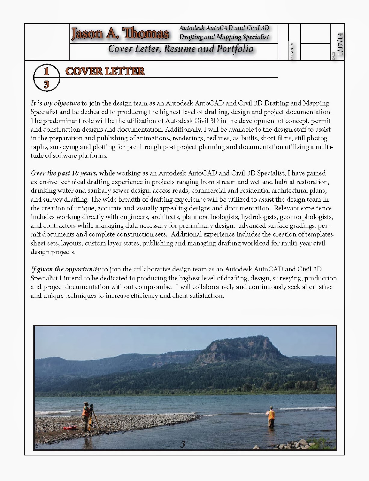
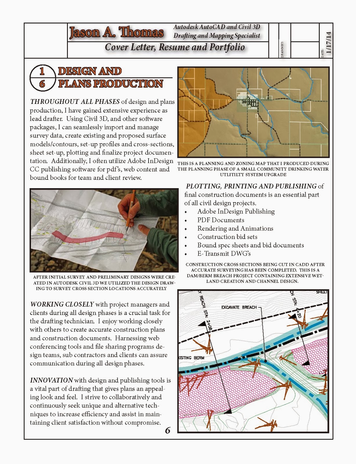
Over the past 10 years, while working as an Autodesk AutoCAD and Civil 3D Specialist, I have gained extensive technical drafting experience in projects ranging from stream and wetland habitat restoration, drinking water and sanitary sewer design, access roads, commercial and residential architectural plans, and survey drafting. The wide breadth of drafting experience will be utilized to assist the design team in the creation of unique, accurate and visually appealing designs and documentation. Relevant experience includes working directly with engineers, architects, planners, biologists, hydrologists, geomorphologists, and contractors while managing data necessary for preliminary design, advanced surface gradings, permit documents and complete construction sets. Additional experience includes the creation of templates, sheet sets, layouts, custom layer states, publishing and managing drafting workload for multi-year civil design projects.


Russian / English Translation and Interpretation Capabilities For Civil Engineering Projects
CAD, CADD, CIVIL 3D, AUTODESK, DRAFTING, DRAFTER, SURVEY, INDESIGN, HEC RAS, GEO RAS ENGINEERING TECHNICIAN SERVICES, AUTODESK MAP 3D, IMPRESSIONS, ADOBE PREMIERE, PHOTOSHOP, ACROBAT, BENTLEY MICROSTATION, GO TO MEETING, ANIMATIONS, PHOTOGRAPHY, RENDERING, 3D PIPE SCHEMATICS, ROAD AND HIGHWAY DESIGN, GRADING, VOLUME CALCULATIONS, LARGE WOODY DEBRIS, BANK STABILIZATION, AQUATIC HABITAT DESIGN, FISH PASSAGE, DAM REMOVAL,DEWATERING PLANS, REVEGETATION PLANS,STAGING, ACCESS, SILT FENCING, ARCHITECTURAL, INDUSTRIAL FACILITIES, COMMERCIAL, FOUNDATION PLANS, DETAILS, DRINKING WATER UTILITY, WASTE WATER UTILITY,URBAN RUNOFF, CITY PLANNING, ZONING MAPS, FOREST ROADS AND ACCESS, CULVERT REPLACEMENT, AIRORTS, RUNWAYS, LIGHTING AND PLANNING.
Subscribe to:
Comments (Atom)